Самое популярное
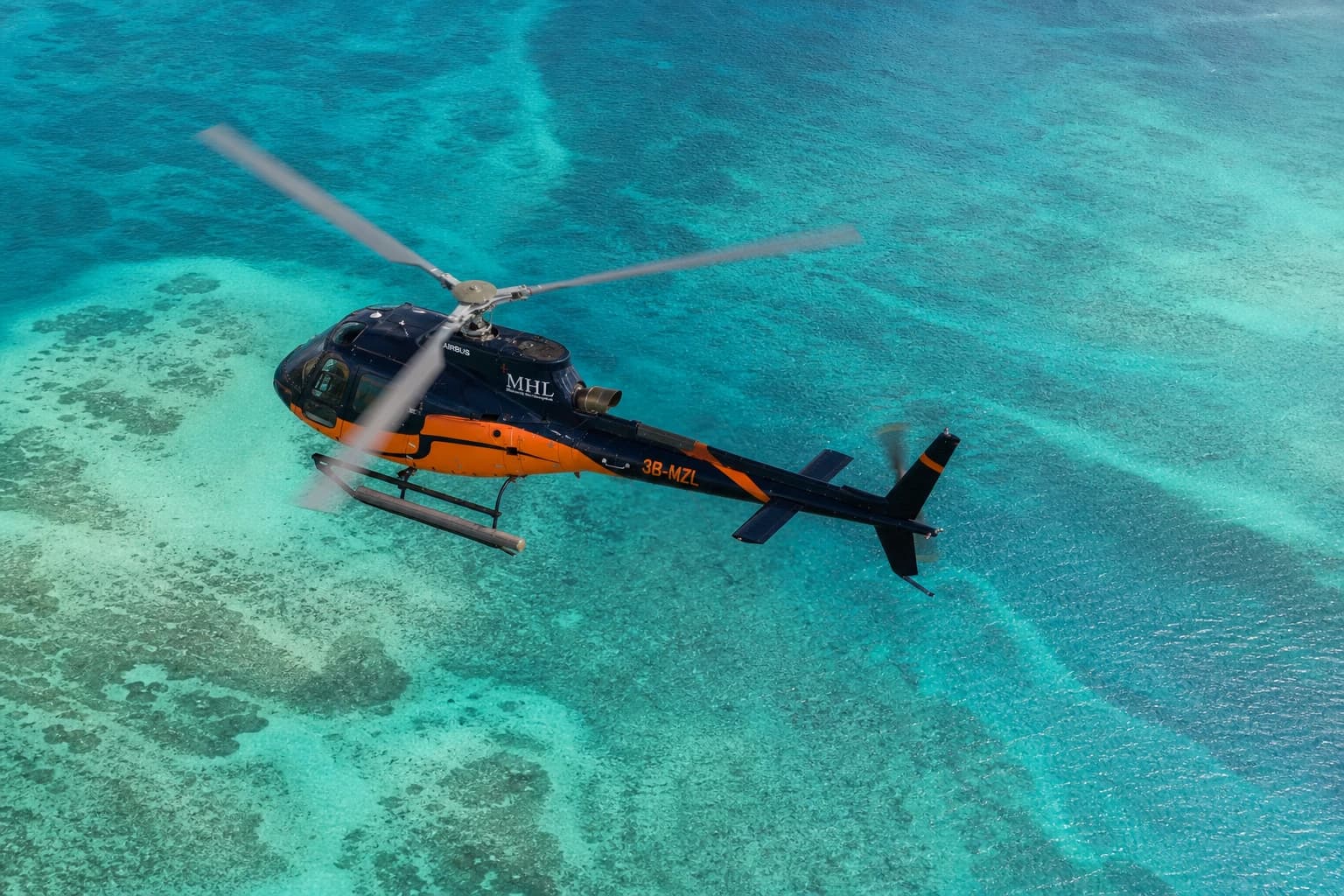
Underwater Waterfall Helicopter Tour from Bel Ombre
15 minutes · Bel Ombre and Le Morne, South West Mauritius
Rs 42,497 за группуНовинка

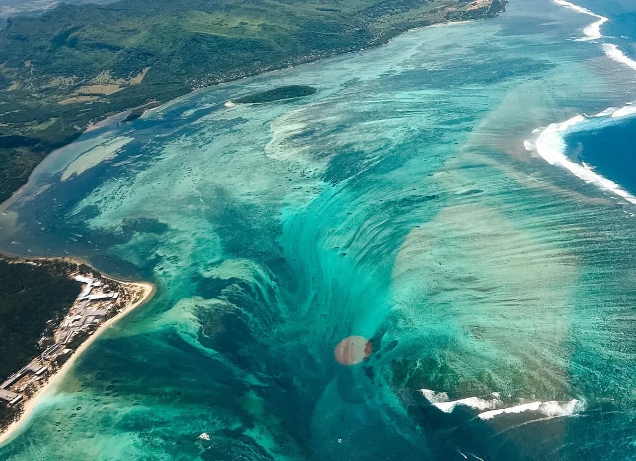
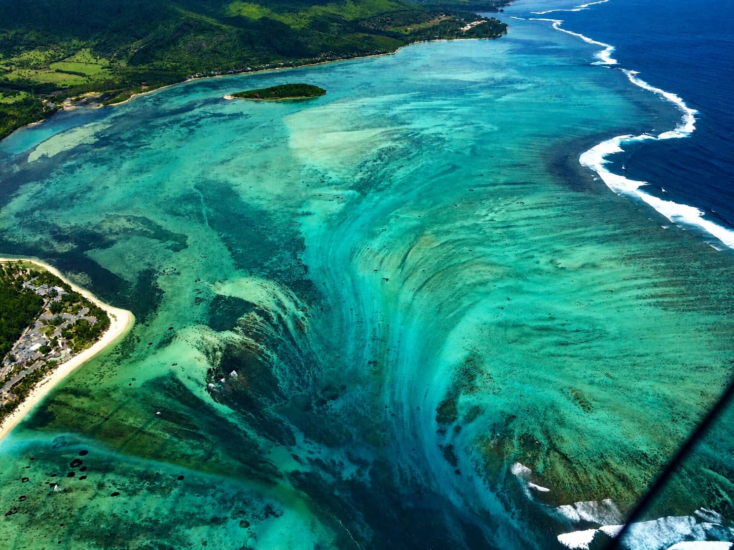
Off the Le Morne peninsula, the seabed seems to plunge over the edge of an underwater cliff. It is an illusion created by sand and silt flowing off the island's shallow shelf into deeper water, and it only reveals itself from the air.
2 flights reach the view, both bookable here
Departs from
Bel Ombre, on the south coast
Time in the air
About fifteen minutes
Seats
A private group of up to six, plus the pilot
The reveal
A direct circuit to the illusion and back
Departs from
Grand Gaube, on the north east lagoon
Time in the air
About one hundred minutes
Seats
One passenger, seated beside the pilot
The reveal
The east coast first, the waterfall as the finale
Nothing is falling. The shelf that carries the lagoon around Le Morne lies in shallow water, and beyond its edge the seabed drops away toward an abyssal plain around four thousand metres deep. Currents drag sand and silt over that edge, and the sediment streams down the slope.
Seen from directly above, the moving sand reads as a waterfall pouring over an underwater cliff. From the beach, a boat or the water itself there is nothing to see, which is why every real viewing happens from the air. You can preview it for free by opening the satellite layer of any map app over Le Morne.
The illusion sits roughly eight hundred metres off the south-western tip of the peninsula, in the channel Mauritians call la Passe Hollandaise, the Dutch Pass. Old charts record the opening at the tip as Passe de La Prairie, kitesurfers know the water nearby as One Eye and Manawa, and divers drift the strong currents of Passe Saint Jacques a little further east, toward Baie du Cap.
The most storied channel lies to the north-west. Passe de l'Ambulante is documented by UNESCO as the way slave ships entered this lagoon, and the way maritime maroons escaped it. The mountain above, a 556 metre basalt monolith, has stood as a World Heritage symbol of resistance to slavery since 2008. The famous view belongs to a coastline that carries far more history than a trick of sand.
Le Morne was already a UNESCO World Heritage site when, in 2013, an aerial photograph of the underwater waterfall spread from Reddit across the internet, its photographer listed as unknown. Within a week an astrophysicist had published the first scientific explainer, and by December the satellite view on Google Earth had made the illusion permanent.
It has since been covered by science outlets, fact-checked by Snopes, which rates the viral image as authentic and only its caption as misleading, and adopted by the island's official tourism promotion. Real underwater waterfalls do exist, and the largest on Earth sinks unseen between Iceland and Greenland. The Mauritian one is the only one you can watch.
Operators schedule flights through the day and never guarantee the sighting, since wind and swell can soften the sand plume. Independent guides consistently recommend calm, clear mornings and the drier months from May to November.
The Le Morne Brabant hike shows the colour boundary between lagoon and deep ocean, and no more. The full shape only forms when you look straight down on it from the air.
Since January 2025 Mauritius requires registration for any camera drone, caps flights at four hundred feet and keeps them away from beaches and public areas. A legal drone flight cannot reproduce this view. An aircraft can.
The waterfall is already visible on the satellite layer of any map app. The flight is for watching it live, with the whole south west of the island underneath you.
There is no actual waterfall under the sea. The image is created by sand and silt flowing off the coastal shelf into deeper water. Real submarine cascades do exist, and the largest sinks unseen between Iceland and Greenland, but the Mauritian one is an illusion you can actually watch.
There is nothing to see in the water itself. The spot lies beyond the reef in open ocean with real current, and at surface level the illusion does not exist. Divers come to this coast for the drift of Passe Saint Jacques, not for the waterfall.
Satellite images show it, and from the Le Morne summit you can make out the colour boundary, but never the shape. From a boat or the beach the angle is too flat. Seeing the waterfall itself means a helicopter or seaplane flight.
Off the Le Morne peninsula at the south west corner of Mauritius, roughly eight hundred metres beyond the lagoon, in the channel known locally as la Passe Hollandaise.
No airline or operator claims a reliable view from scheduled flights, and arrival routes rarely oblige. The dedicated helicopter and seaplane routes exist because they are the way to see it.
Both routes to the underwater waterfall are bookable on Andeor, alongside every other scenic flight on the island.
View all scenic flights